Keep the inn still, and let the city move
Kyoto Station, Gion and Higashiyama have not always been the city’s centre.
Political authority, culture, production, everyday life and transport have each pulled Kyoto’s centre of gravity in different directions. Keep the inns at the same point across seven maps, and a different story appears: the accommodation did not move away from Kyoto—the meaning and location of “central Kyoto” kept changing around it.
These maps explain broad urban change. Coloured areas and historic sites are conceptual and do not represent surveyed property or archaeological boundaries.
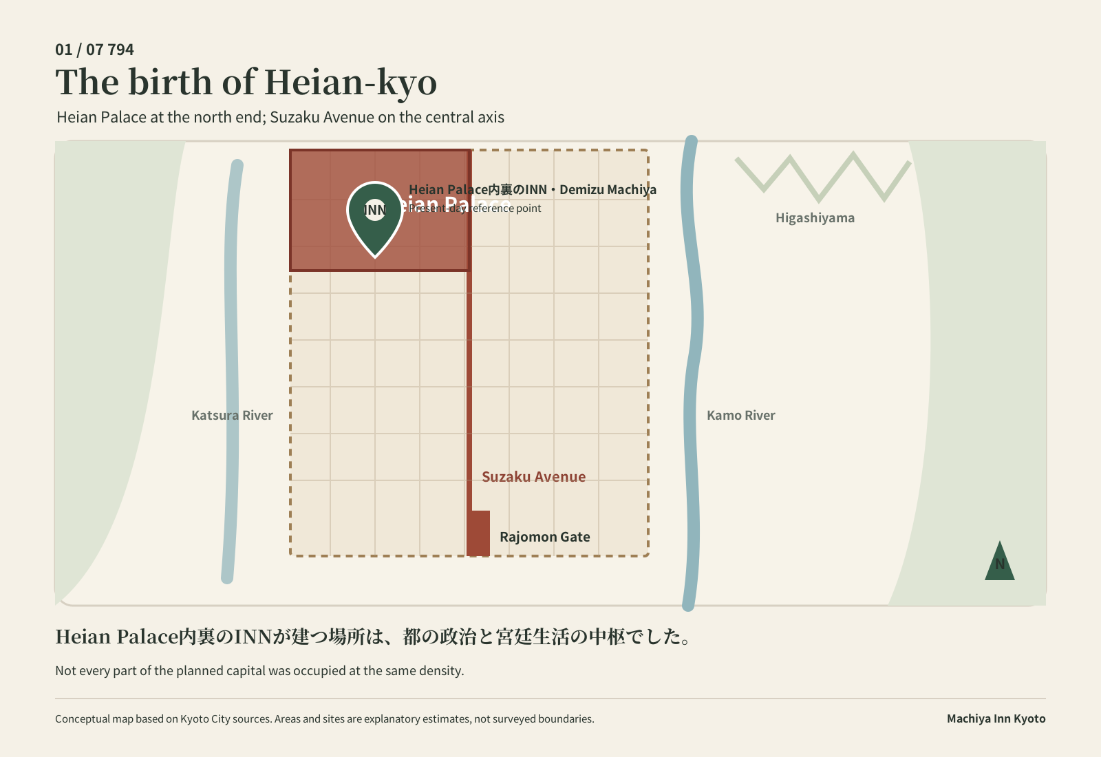
The birth of Heian-kyo
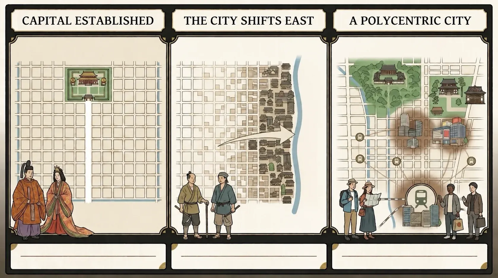
Kyoto’s political and courtly centre stood at the Heian Palace.
Suzaku Avenue formed the city’s central axis, with the palace at its northern end. The area around Heian Palace Inner Palace Inn and Demizu Machiya overlaps the estimated grounds of the palace enclosure. The planned capital did not, however, become equally urbanised throughout.
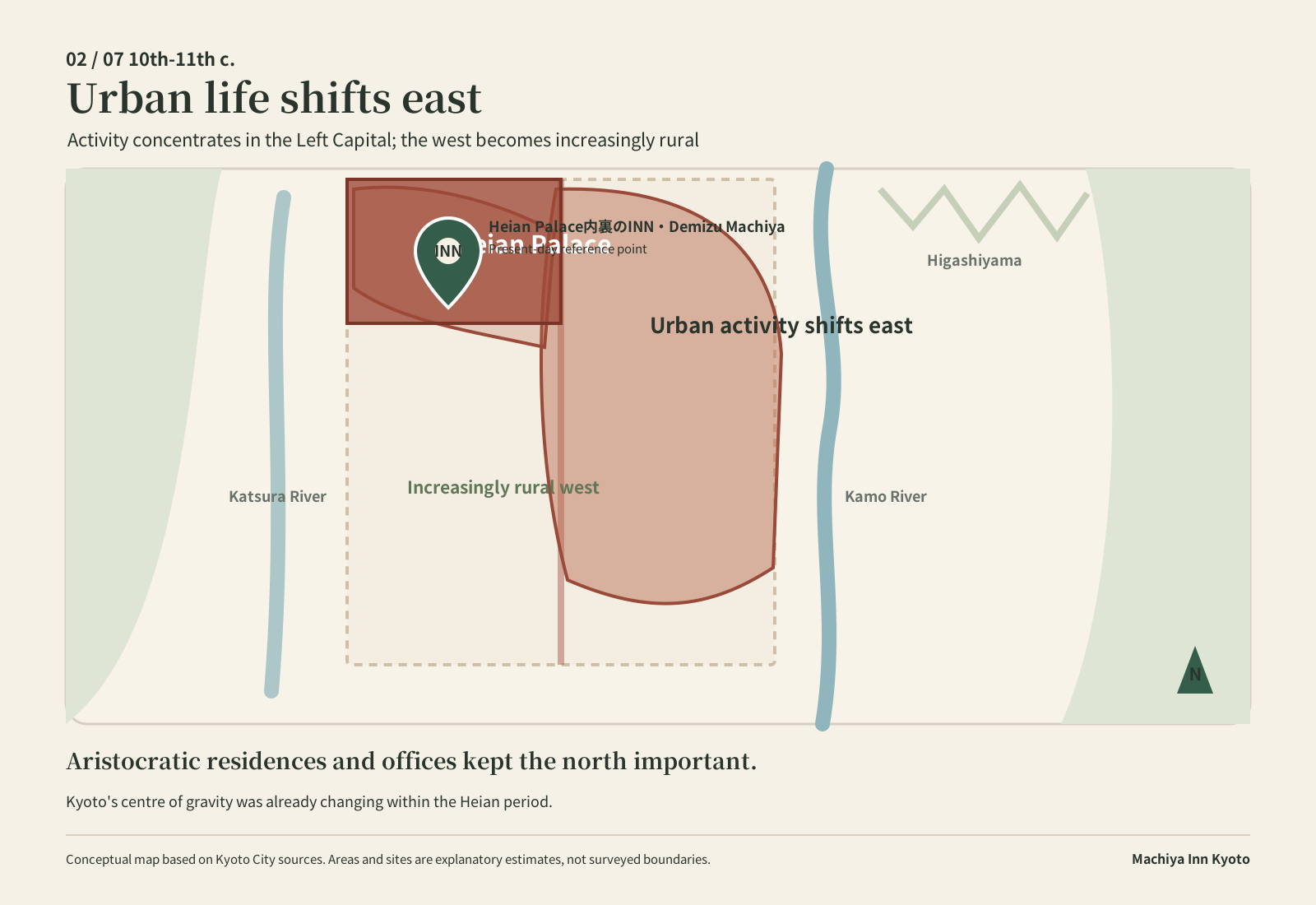
Urban life shifts east
Heian-kyo did not retain the symmetrical form in which it was planned.
Urban activity increasingly concentrated in the eastern, or Left Capital, side, while much of the western side became rural. Aristocratic residences and government offices remained numerous around First and Second avenues in the north.
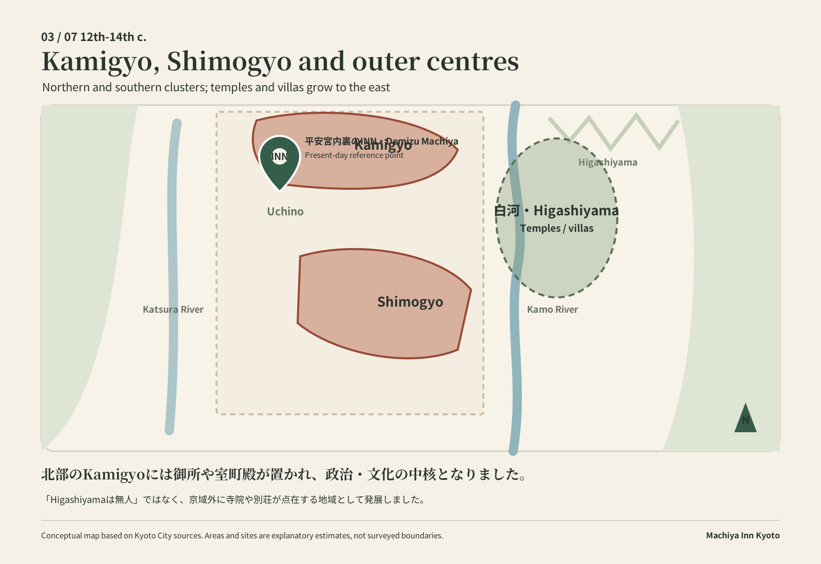
Kamigyo, Shimogyo and new outer centres
The city developed in northern and southern clusters, while important places grew beyond the old capital grid.
Kamigyo took shape in the north and Shimogyo in the south. The former palace grounds declined and became known as Uchino. The Imperial Palace and the Muromachi Palace became northern focal points, while temples and villas developed around Shirakawa and elsewhere outside the old grid. This does not mean that Higashiyama was empty or wholly undeveloped.
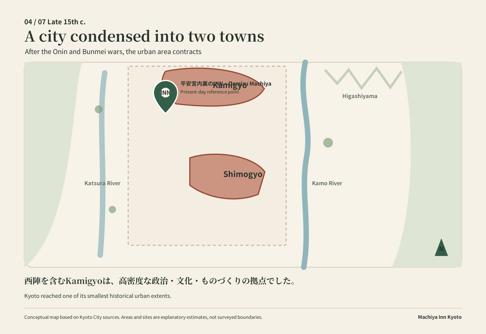
A city condensed into two towns
After the Onin and Bunmei wars, the built-up area contracted around Kamigyo and Shimogyo.
Kyoto reached one of its smallest historical urban extents. Yet the proximity of courtiers, warriors, monks, craftspeople and merchants fostered an unusually dense urban culture. Kamigyo, including Nishijin, was one important centre of politics, culture and production—not Kyoto’s only centre for all time.
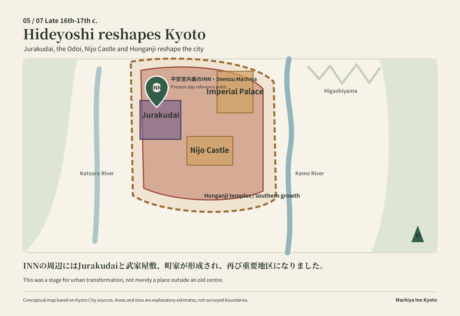
Hideyoshi reshapes the city
The neighbourhood around today’s inns again became part of a major urban transformation.
Toyotomi Hideyoshi built Jurakudai and the Odoi earthworks and reorganised the city blocks. Later, the Imperial Palace and Nijo Castle formed two political poles, while the establishment of the eastern and western Honganji temples encouraged urban growth south of Sixth Avenue.
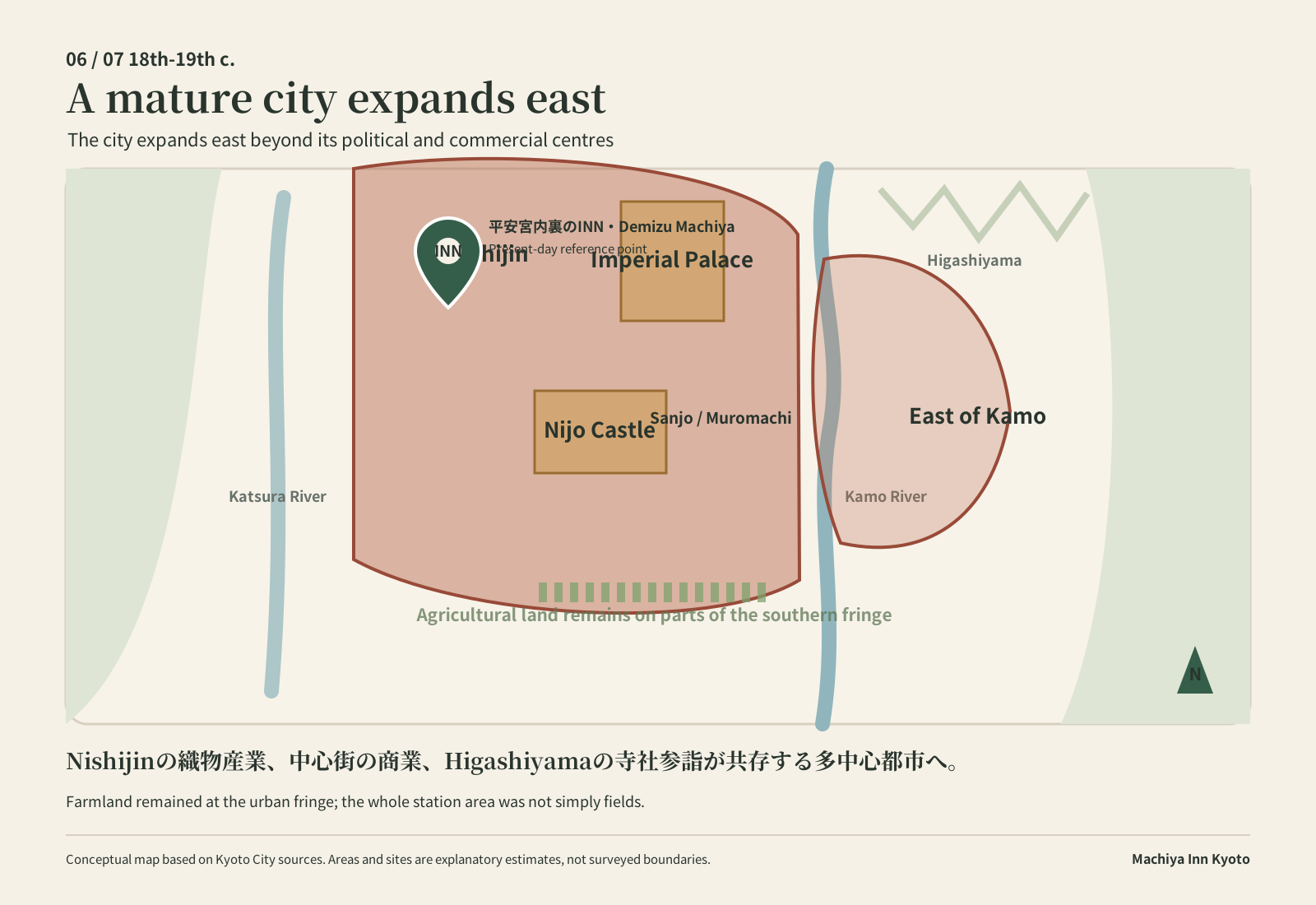
A mature city expands east of the Kamo River
Kyoto came to hold several centres with different roles.
The Imperial Palace and Nijo Castle coexisted with commerce around Sanjo and Muromachi, textile production in Nishijin, and pilgrimage and leisure in Higashiyama. Following major fires and the relocation of townhouses, built-up areas spread east of the Kamo River. Agricultural land remained along parts of the southern fringe, but it would be misleading to describe the entire Kyoto Station area simply as fields.
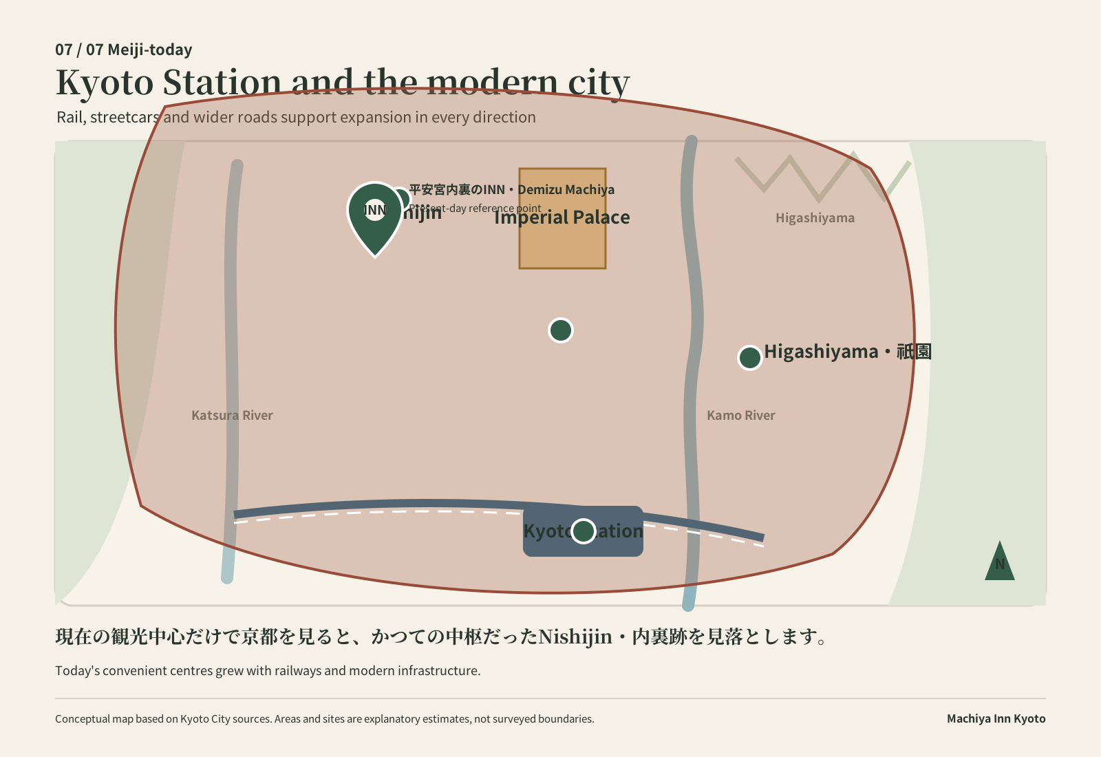
Kyoto Station and the modern city
Today’s convenient centres are one chapter in Kyoto’s much longer history.
The first Kyoto Station opened in 1877. Railways, streetcars, wider roads, the Lake Biwa Canal and other infrastructure helped the city expand in every direction. Today’s image of Kyoto Station, Shijo-Kawaramachi, Gion and Higashiyama as transport and visitor centres reflects another stage in that continuing change.
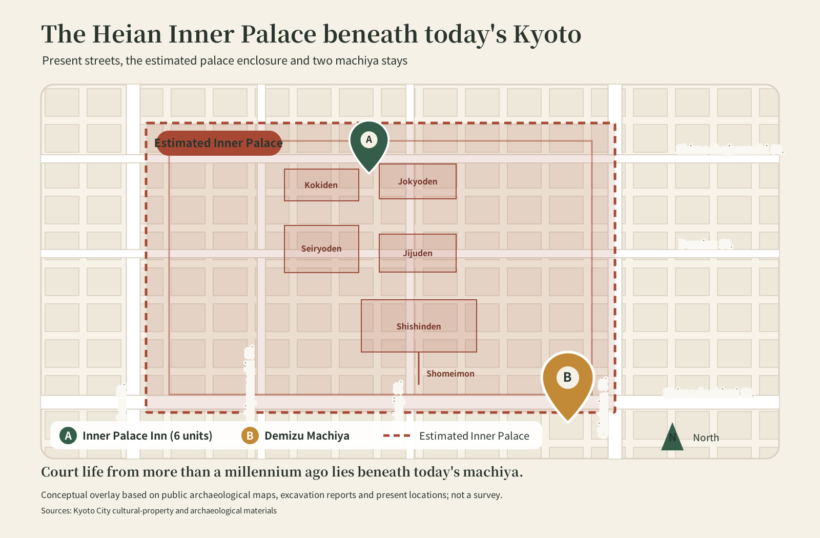
THE PALACE BENEATH TODAY’S STREETS
Layering the Inner Palace over present-day Kyoto
This conceptual overlay brings together today’s streets and a reconstructed outline of the Inner Palace. A marks Heian Palace Inner Palace Inn and B marks Demizu Machiya. A is shown between Kokiden and Jokyoden, but the map does not claim that a modern property boundary exactly matches an individual palace building.
STAY WITH THE STORY
Stay where an older centre of Kyoto once stood.
The Heian Palace, Uchino, Jurakudai and the later townhouse neighbourhood have all left layers of memory beneath these streets. Heian Palace Inner Palace Inn and Demizu Machiya offer a base for discovering a Kyoto that is easy to miss when the city is viewed only through today’s busiest visitor districts.
Frequently asked questions
Where was the centre of Heian-kyo?
In the planned capital, Suzaku Avenue formed the north–south axis and met the Heian Palace at its northern end. “Centre” changes meaning, however, depending on whether we are discussing politics, commerce, culture or transport.
When did Kyoto Station open?
The first Kyoto Station opened in February 1877. The present building is the fourth station building.
Was Nishijin the centre of Kyoto?
Nishijin and the wider Kamigyo area were important centres of production, culture and political life. They were not Kyoto’s single centre throughout every period.
Was Higashiyama developed only later?
That is too simple. Even beyond the original Heian-kyo grid, temple and villa districts had developed around places such as Shirakawa by the medieval period. The history of settlements and religious sites is not the same as the expansion of a continuous built-up area.
Sources and verification
- Kyoto City, “Changes in the Shape of Kyoto” (urban change; checked 19 September 2026)
- Kyoto City Cultural Properties Protection Section, excavation bulletin on the Inner Palace corridor (the palace, Uchino and surrounding land use; checked 19 September 2026)
- Kyoto Prefecture, “Nishijin-ori” (the name Nishijin and textile production; checked 19 September 2026)
- Kyoto Station Building, station history (checked 19 September 2026)
Machiya Inn Kyoto created these explanatory maps with reference to the sources above. They do not certify modern property boundaries, exact archaeological limits or a match with individual historic buildings.